Are there alligators in the Dismal Swamp?

Estimated reading 12 – SBFL 14* – PLANNING TO VISIT– Before we get to alligators, it is hard not to recall our Slow Boat to Florida journey up to now. We avoided challenging seas and traveled only in fair weather for our trips of discovery. We are determined to be on the water only in fair weather. Once we rushed and made a couple of wrong choices. That is a reality in boating, of course. But, honestly, thankfully that did not happen working on this series. It was another trip and since then our daughter has refused to join us whenever we have trips longer than 30 minutes out on the open waters. For this series, we are on our way to Florida on the eastern seaboard going from the north on the (Atlantic Intracoastal Waterway (ICW) down to the south. We started our journey in Maryland. We visited Baltimore, then near the Chesapeake Bay Bridge, we turned east into the Chester River and visited Chester Town. We came back to the Bay and passed by our Milliarium Aureum – Golden Milestone. Then came Annapolis, St. Michaels, Oxford, Cambridge, Solomons, Crisfield, and finally Smith Island. After that, we entered the Virginia waters of the Chesapeake Bay, stopped over in Tangier Island, passed by Mobjack Bay and the York River, then arrived in the Hampton Roads area. We are now in Norfolk. Well, kind of, sort of. In fact, we visited some of these towns but were only able to plan our visits to some of the others due to the pandemic. Unfortunately, just like the entire world, the pandemic negatively affected all our Slow Boat to Florida* journey plans and tied us down onshore just like many millions of others.
Now and then, I recall the sentiment of a seasoned cruising couple who did a one-year-long journey along America’s Great Loop. They were saying if you are planning to have a trip, don’t wait, just do it while you can, you never know what may be waiting for you to stop all your plans. How true—what if we did the trip back in 2019 rather than plan to do it in 2020? Could we ever dream of the Covid Pandemic that turned our lives upside down and still continues raging in many parts of the world? In other words, anything can happen and derail our goals. Then I recall the wisdom of Confucius. He said, “When it is obvious that the goals cannot be reached, don’t adjust the goals, adjust the action steps.” So, our action steps for this series have changed and it has been to plan, study the locations, and develop familiarity with the places that we will be visiting while following the footsteps of the National Geographic authors who captured their impressions of the same ICW journey, first back in 1958 and then in 1973.

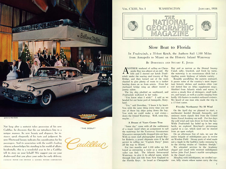
We are comparing then and now, in a deliberately planned slow journey, hence the title of this series, “Slow Boat to Florida.” Credit for the title goes to Dorothea and Stuart E. Jones in their 1958 National Geographic article titled, “Slow Boat to Florida.” I expect the duration of our journey to be much longer than the Jones’, our National Geographic authors.

As someone said, “In an age of speed, I began to think, nothing could be more invigorating than going slow.” We decided to slow down at a pace so that we can catch all the beautiful details of our surroundings, people, and places. That is the essence of our SBFL* series. The pandemic threw cold water on our hot pursuit of finding what has changed since then. How America and Americans look now compared to then. Covid stopped our societal glorification of being busy and slowed down the entire humanity, whether we wanted it or not.
“Sometimes, if you stand on the bottom rail of a bridge and lean over to watch the river slipping slowly away beneath you, you will suddenly know everything there is to be known,” said Winnie-The-Pooh
On the way to the Dismal Swamp
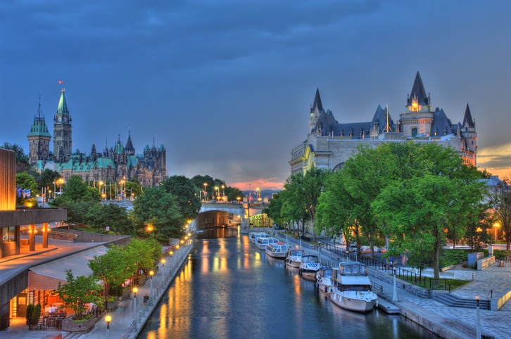
If you are in Norfolk and have passed the ICW zero mile marker on the Elizabeth River, you better be careful. If you really want to continue down south to Florida, make sure to take the Southern Branch of the river on the fork. The objective is to get to the Albemarle Sound; however, you also have to make an additional choice, yes, in advance. You either can proceed down south via the Dismal Swamp Canal or the Albemarle Chesapeake Canal. There are a large number of cruising guides that will provide you with detailed insight to help you make your choice. However, in our case, our National Geographic authors* already made the decision for us. They both took the 22-mile-long Dismal Swamp Canal on the way to Elizabeth City, North Carolina. We intend to take the same route. We need to line up the stars far in advance and find out the status of the canal well before we get to Norfolk.
Dismal Swamp Canal not so dismal
“Tranquility and a dreamlike sense of solitude and remoteness enveloped the boat and crew. Our bow cleaving that placid water, the gentle V of our wake, the low throb of the engine—these things seemed intrusive, and I cut the throttle back to little more than idling speed. ‘A dull, monotonous place …,’ ‘Not much variety, not much to see.’ That’s the way two veteran Waterway travelers had described the Dismal Swamp Canal to me,” Allan C. Fisher, Jr., wrote back in 1972 right after he entered the Dismal Swamp Canal after Norfolk in his book titled, “America’s Inland Waterway.” He is one of our two National Geographic authors that I have been referring to. The others are Dorothea and Stuart E. Jones, who sailed 1100 miles from Annapolis to Miami with their boat Tradewinds, a 35-foot Ketch, in 1958. Referring to the canal, the Jones’ wrote, “The 22-mile canal, one of the first artificial waterways in the United States, linked Virginia’s Elizabeth River and Hampton Roads with North Carolina’s Pasquotank River and Albemarle Sound. Slaves began digging the canal late in the 18th century.”
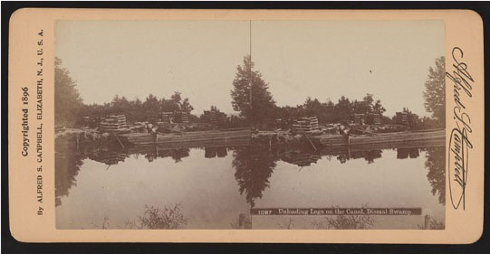
Referred to as the Ditch by boaters, the Dismal Swamp Canal is a part of the ICW. It is on the Eastern edge of the Great Dismal Swamp and the Dismal Swamp State Park. Don’t expect to see the unusual scenery that’s shown on the cover photo of this blog post while you are on the Canal. Those trees are located on the shores of Lake Drummond within the Great Dismal Swamp National Wildlife Refuge, which is right beside the canal. The lake contains fresh water and the bottom of the entire swamp has a layer of peat. Today, the Great Dismal Swamp National Wildlife Refuge is the largest intact remnant of a vast habitat that once covered more than one million acres of southeastern Virginia and northeastern North Carolina going back 13,000 years. Formal protection of this resource began in 1973, well after the Jones’ published story in 1958, as well as right after Fisher’s book published in 1973. It was when the Union Camp Corporation (a local forest products company) donated 49,097 acres to The Nature Conservancy. The Nature Conservancy conveyed the donated land to the federal government, which, combined with additionally-purchased land, was used to establish the Great Dismal Swamp National Wildlife Refuge in 1974.

That brings us to the question of if Alligators live in the Dismal Swamp? It turns out that they do not. Alligators can be found in Merchants Millpond State Park, North Carolina, just south of the Dismal Swamp, and at Kitty Hawk. None live naturally in Virginia – yet. However, a warming climate may yet result in a natural range expansion northward across the border into the Dismal Swamp.
The refuge currently encompasses over 112,000 acres of this environmentally and biologically important area. Special designations for the refuge include both the Virginia and Globally Important Bird Area designations, and the National Parks Services National Natural Landmark and Underground Railroad Network to Freedom site designations.
Referring to the swamp, the Jones’ in 1958 wrote, “Legend has peopled the swamp with ghosts, savages, moonshiners and desperate criminals fleeing the law.” The Jones’ continued, ““Hair-raising tales of enormous reptiles, poisonous plants, and treacherous peat bogs have also come out of the Great Dismal, which once spread over approximately 2,000 square miles of Virginia and North Carolina. Today drainage and a falling water table shrunk it to an estimated 385 square miles, and hunters and school nature-study groups roam the game-rich swamp.” Here is some good news for all of us. Today in 2021, thanks to conservation efforts, the surface of the swamp has improved and now it is about 750 square miles. Perhaps one day it will catch up to its original size. As for the tales of the swamp, we now know that many escaped slaves from the south made permanent and safe homes in the swamp and it became a part of the Underground Railroad Network to Freedom.
Both the Jones’ and Fisher tied up their boats somewhere in the canal and took a charter boat trip into Lake Drummond. Also, both continued and reached Elizabeth City on the shores of the Pasquotank River in North Carolina.
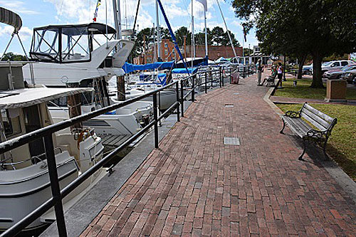
Elizabeth City, North Carolina—one of the best small towns in America
Just like the Jones’ and Fisher, we too plan to visit Elizabeth City and compare then and now before we venture off to the notorious Albemarle Sound. As Fisher puts it, “Many experienced boatmen think it the roughest, most treacherous body of water on the entire Atlantic Intracoastal route. Here the seas often become highly unpredictable, and the waves take on a steepness not always warranted by the strength of the wind.”
So, after we take in all the Dismal Swamp Canal journey offers, just like our authors, we, too, will enter North Carolina stop by Elizabeth City, and enjoy ourselves. It is an interesting city with a slow community growth during both the Jones’ time in 1958, as well as Fishers in 1973. They have had a steady population of 15,000 or so. Fisher said, “A trading center with many handsome residences, Elizabeth City is not only the gateway but the metropolis of Sounds Country. Yet the community contains only 15,000 people and growth has been slow.” In fact, the population was around that number back in 1958 during the Jones’ time as well. Now 63 years later, the population is around 18,000. As Fisher said, ”A lot of people like it that way.” Today, Elizabeth City has been named one of the “100 Best Small Towns in America” and is ranked by Money Magazine as “one of the best places to live on the East Coast.” The city lies just west of the Outer Banks of North Carolina. It is rich in history, yet progressive and growing.
In Elizabeth City, we plan to follow the footsteps of the Jones’ and take an excursion to the Outer Banks, the birthplace of flight. As for crossing the Albemarle Sound, although it would extend our trip a bit, we may take advantage of the Albemarle Loop and plan to cross the sound from its narrower spot rather than taking the more direct route across more open water. Did we say this is a Slow Boat to Florida journey? Trust us, it really is. Although our destination is Florida, our journey is the entire trip.
Well, that’s it for now. Stay well. I hope to say hello to you if you spot my boat, Life’s AOK, in one of the locations that I’m hoping to visit in 2021, that is, if Coronavirus permits us.
I bid you Fair Winds and Following Seas.
3 things I learned
- The Great Dismal Swamp once was purchased by George Washington.
- You can find out more about the Great Dismal Swamp here in the US Fish and Wildlife Service brochure.
- Just in case you were wondering what the difference between Alligators and Crocodiles is, you need to read a bit more on the topic.
1 thing I recommend
- Today most boats in the ICW prefer to take the Virginia Cut (a. k. a. “Albemarle and Chesapeake Canal”) due to having deeper water and only one lock to negotiate. However, resist the temptation and take the Dismal Swamp route and visit Elizabeth City. I believe that you will not be disappointed.
How easy?

*SBFL stands for Slow Boat to Florida. It is a series of my blog posts, which started with a posting that had the same title. Each numbered heading has two parts. The first is “Planned or Planning to visit,” and when we visit the planned location, a “Visited” label appears at the beginning, next to SBFL. The essence of this series is not to seek new lands and exotic cultures. Rather, it is to cover our journey of discovery (hence the title of our blog Trips Of Discovery) that has to do with seeing with a new eye the coastal locations of the Atlantic Intracoastal Waterway (ICW) where present-day America started to flourish. The SBFL series represents part travel, part current and historical anthropological highlights of selected locations and coastal life. We’re comparing then and now, based on observations made by Dorothea and Stuart E. Jones in their 1958 National Geographic article titled, “Slow Boat to Florida” and a 1973 book published by National Geographic, titled America’s Inland Waterway (ICW) by Allan C. Fisher, Jr. We also take a brief look at the history of the locations that I am writing about. Finally, we bundle it up with our observations during our actual visits to the locations and our interviews with local residents. Think of it as a modest time capsule of past and present. My wife and I hope that you, too, can visit the locations that we cover, whether with your boat or by car. However, if that is not in your bucket list to do, enjoy reading our plans and actual visits as armchair travelers anyway. Also, we would love to hear from you on any current or past insights about the locations that I am visiting. Drop me a note, will you?