Tips for cruising through America’s Great Loop – Part 3
If you can dream it, you can do it. —Walt Disney
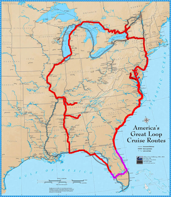
… Estimated reading time 17 minutes – In Part 1 of this story, perhaps you started to dream about America’s Great Loop and got a glimpse of what it is to be a Looper through Phyllis and Dick Radlinski’s eyes and experiences. They left the Chesapeake Bay in the summer of 2014, went north to New York, and from there passed on to Canada’s great canal network. After piloting through Canadian waters, they transited through two historic canal systems and 90 locks—yes, 90 locks—then Georgian Bay and the North Channel of Lake Huron down to Michigan.
In Part 2, vicariously, through the Radlinskis’ experiences, we continued our adventure, headed down to the Gulf of Mexico from north Michigan by crossing the entire US from north to south through the Western River System (Illinois, Mississippi, Ohio, Tennessee, and Tombigbee), ending up in Mobile, Alabama, on the Gulf of Mexico.
The road to your dreams isn’t always easy to navigate but worth the trip
In Part 3, the last in our Great Loop series, we will cross the Gulf of Mexico, go up the Atlantic Intracoastal Waterway (AICW), and finally arrive at the Radlinskis’ home waters, the beautiful Chesapeake Bay.
Having a pleasure boating adventure in America’s Great Loop and becoming an official “Looper” is not a lonely experience for those who planned it far in advance. In fact, it is an essential pre-cruise task to plan your travel regardless of the length of it, be it 1 day or 1 year. If you think about it, we don’t even go shopping by car on land before we make some kind of plan, let alone 6,000 miles. While you can definitely do solo travel without talking and coordinating with anyone, in order to have the most pleasant adventure experience of a lifetime to become a Looper, you must start with serious planning and networking.
Membership matters
That is where the America’s Great Loop Cruisers Association (AGLCA) comes in to play an important, even crucial role in your adventure. If you are dreaming or actively planning to become a Looper, you need to become a member of AGLCA, long before you put your first mile behind you on the water. For full disclosure, we are not planning to become Loopers and we are not being compensated by AGLCA to promote them here. However, as experienced pleasure boaters who are planning to do an Atlantic Intracoastal Waterway ( AICW) trip for our Slow Boat to Florida series, we know very well the importance of detailed planning and being a part of a network of boaters. That is why if you want to become a Looper, we are emphasizing the importance of a membership in AGLCA far in advance of your actual start year.
Okay, so you became an AGLCA member, what should you expect? How does it tie back to the Radlinskis’ experiences that you have been reading about? For the first part, I talked to Kimberly Russo, the Director of AGLCA, and asked about the major Looper support that they provide. She said, “AGLCA holds two large Rendezvous each year along the Great Loop route. The location is selected based on where Loopers following the route would tend to be at that time of year. Each spring, the 4-day Rendezvous is on the east coast, most recently in Norfolk, Virginia.”
During the 4-day spring event, they have two seminar tracks, each containing about 20 hours of material. Their “Looping 101” track includes information most helpful to those planning for the Great Loop, covering topics to assist them in making the trip safely and comfortably, such as selecting the right boat for them, anchoring, weather, etc. The second track is a “Route Session” track, which covers the route in detail, including navigation information, favorite stops, anchorages, marinas, and things to see and do. “The Spring Rendezvous,” said Russo, “tracks the route from the location of that event through the northern portion of the route to the site of the Fall Rendezvous.“
Tactical support that all boaters need
The Fall Rendezvous was held at Joe Wheeler State Park in Alabama along the Tennessee River. Russo said, “The Fall Rendezvous is similar to the spring event, but it covers the southern half of the route. The two together cover the entire route with the details Loopers need to help them complete it.”
I asked Russo about the detailed location information provided, such as marinas along the way and recommended stopover locations. I wondered if AGLCA has agreements in place so that active Loopers would be recognized and somewhat benefit from their relationship. She said, “Not all stops along the way have a relationship with AGLCA. We do have a series of sponsor marinas that tend to offer discounts to Loopers on dockage and/or fuel. Many also offer briefings to give current navigation information for the next leg of the trip for a small distance from the marina. We always encourage our members to support these sponsors, as they support Loopers and AGLCA!”
The Radlinskis, as well as others, attest that there are dozens, if not hundreds, of Loopers on any leg of the 6,000-mile journey at any given time. Naturally, there are hundreds of potential stopover locations, thousands of possible visiting spots on the waterways, as well as limitless possibilities of individual Looper schedules. On top of that, there are thousands of boats and vessels on the water. How do they find their fellow Looper travelers who they may have met during one of the Rendezvous to just say hello or perhaps, if they are going to the same spot, coordinate traveling together for a while?
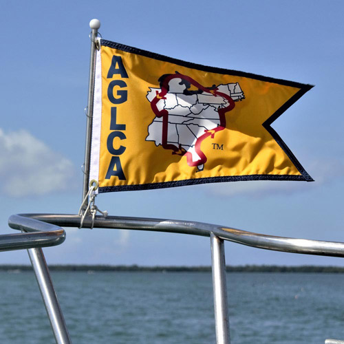
Well, it seems that AGLCA has solved that problem. They have one low-tech and another, high-tech solution that every Looper takes advantage of. The low-tech solution has to do with each Looper boat having one of the three AGLCA burgees on their boat. If you see a boat in a marina that is carrying one of those special burgees, you can just simply reach out to them in person or by your VHF Marine radio and talk to them.
On the high-tech front, Kimberly Russo said, “AGLCA has adopted Nebo as our member tracking application.” AGLCA’s free official member tracker app – Nebo – is available to anyone. Nebo is a boat logging app that makes it easy to record and share your boating memories and experiences. You can share your boat log with family and friends, members of your club, or with the larger community via social media.
If you are a member of AGLCA, your fellow members are shown in the app with the AGLCA logo for you to easily spot them. Explaining the service, Russo said, “It allows boats to opt-in to sharing their location and tracks their journey, creating a log of each leg of the trip. Members can find each other and communicate via the app, and you can give those at home a link to follow your boat. The app works on a smartphone or tablet, but the NeboTracker is a separate piece of hardware that adds an extra layer of reliability to the system, while not gobbling up the data on your primary cell plan or depleting the battery charge on your smart device. The tracker also eliminates the problem of forgetting to start the app in the morning to track your progress. Every time the boat moves, the tracker records the movement.” In other words, unless you prefer otherwise, you will not be alone on your journey. You will be keeping in communication with fellow travelers along with your contacts in social media.
So, after this tactical background information, let us continue our journey. We’ll pick up at the point at which Phyllis and Dick Radlinski reached Mobile, Alabama.
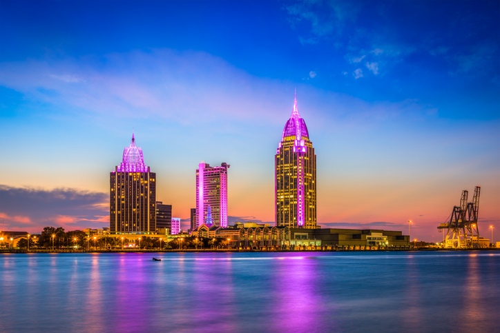
The city sits on Mobile Bay, which within 25 miles opens up to the Gulf of Mexico. When you head out of Mobile Bay, you have two options in proceeding to Florida to catch the Atlantic Intracoastal Waterway.
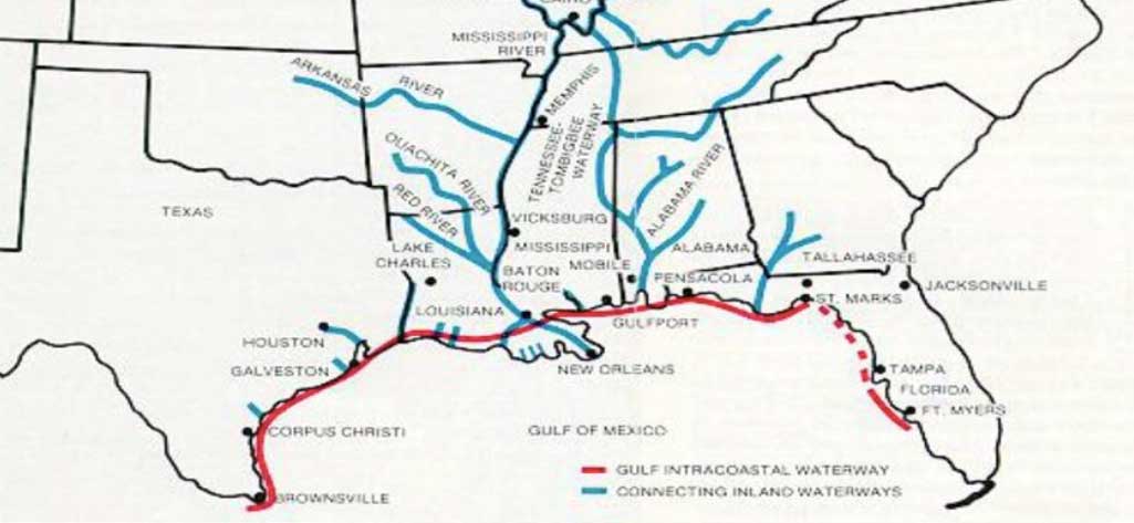
The first option is to catch the eastern bound leg of the Gulf Intracoastal Waterway (GICW) east to Florida.
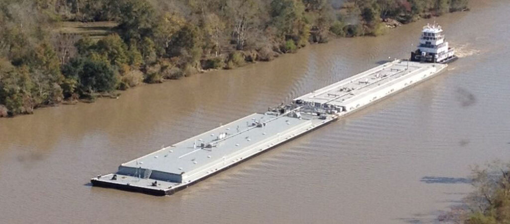
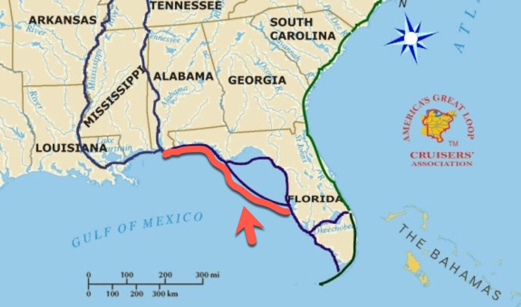
The GICW is a 1,100-mile man-made coastal canal stretching from Brownsville, Texas, to St. Marks, Florida. A few segments were intended to be connected via a dredged waterway from St. Marks to Tarpon Springs and the Cross Florida Barge Canal in northern Florida (now officially the Marjorie Harris Carr Cross Florida Greenway), but these projects were never completed due to environmental concerns. So, you need to get off at Carrabelle, Florida, and enter into the Gulf of Mexico. After a short trek out into the Gulf of Mexico, you will need to follow the coastline of Florida down to the Caloosahatchee River and go in 12 miles to reach Fort Myers.
This route requires you to go in and out of the shore, many times. Once you reach Fort Myers, you are ready to cross Florida by taking the Okeechobee Waterway to the Atlantic Intracoastal Waterway. Many pleasure boaters do not consider this route due to the shallowness of the Florida coastline in the region. They say, jokingly, in the shallow spots, for some reason if your boat takes water, you can walk to the shore.
The second and more preferred option is to take the GICW again until you reach Carrabelle on the Florida Panhandle, then cross the eastern Gulf of Mexico (requiring you to go much further out in the Gulf of Mexico) until you can pick up a noncontiguous segment of the GICW on the west coast of Florida. The catch on this route is that if the winds are more than 15 miles per hour, the water will be choppy or worse. Again, the reason most traffic crosses the open waters of the Gulf from Carrabelle, Florida, to reach the west coast of Florida is that the water near the shore is very shallow, especially in “The Big Bend” of the Panhandle coast.
The route from Tarpon Springs (considered the sponge capital of the world) to the Florida Keys is considered Florida’s West Coast. This shoreline encompasses the big-city port of Tampa Bay, the islands of Sanibel and Captiva, quaint fishing villages, and the vast swamplands of America’s Everglades guarded by the Ten Thousand Islands. The upper portion of the west coast down to Naples is more commercial, while the lower half is more underdeveloped, with sandy beaches, pines, and a jungle-like environment. This part of the GICW begins at Mile 0 at the mouth of the Caloosahatchee River.
Boat watch schedule anyone?
Along the way, the Radlinskis were considering their options and decided on the second option. Dick said, “We traveled across Mobile Bay to the GICW, which skirted the northern border of the Gulf. That allowed us to go east to the Florida Panhandle without entering the open waters of the Gulf.”
By the time Radlinskis reached the town of Carrabelle, they found 17 other Looper boats in the marina that were contemplating crossing the Bay. AGLCA’s daily local marine weather forecast for the next day looked okay. In addition, the guy that produced the daily forecast was in one of the Looper boats. Phyllis said, “All of us gathered and talked about it in the marina—if the next day was a good day to cross the Gulf.” The weatherman said he researched it and he thought that everything was going to be fine the next day. After all, this was the same route taken regularly by a single boat or perhaps by two boats keeping each other company. He told the Looper flotilla it would only be terribly rough possibly for one hour or so, and added that he thought they should all go. All agreed to go and for safety reasons, they decided to stay together and leave at the same time the next day at 4:30 p.m., all heading to Florida.
Phyllis said, “The next day, all 18 boats left at the exact same time. However, one hour of choppy waters did not turn out to be true. It lasted the entire time we were out there and got worse. One boat couldn’t take the weather. After an hour of fighting the elements, they decided to turn around and go back to Carrabelle, Florida. Upon reaching the town, the captain ended up in the emergency room due to back issues caused by rough water.”
Typically in normal conditions, the Radlinskis would take it easy, do this kind of 170-mile crossing in two days non-stop, and have fun while they were doing it. As all seasoned boaters know, when a boat does 24 hours or more on a non-stop water crossing, they use a boat watch schedule.
However, in these treacherous conditions, they had no option but to press on, and get it over with. Go fast they did. The Gulf was not showing its better side, it was raging and did not lighten up. They completed the journey in 22 hours, non-stop, slapped around by the Gulf waters. Recalling that part of the journey, Phyllis said, “Much of the time it was pitch black (no moon at night) and very rough (the weatherman was wrong!), so neither one of us got any sleep.” Dick added, “Even the bigger boats experienced something.” So much for their boat watch schedule, which they had planned for rotating shifts of 3 hours of sleep and 3 hours of piloting the boat.
Rocking and rolling the boater’s way
The water was slamming against everything. Dick said, “With the wind and everything, neither one of us had any sleep whatsoever the entire time. Even the bigger boats in the flotilla experienced the same thing.”
It was a journey that no one could forget. Dick’s boat, “Wye Tug,” was in the center of a group of 6 or so, in sight of one another. A few boats were trailing behind. Dick’s group slowed down a bit to about 7 knots so that they could catch up, but all kept going, they had to. Some other powerboats were faster and went ahead of the pack.
Along the way, three different boats’ fuel filters clogged up, and they started to experience problems. All the rocking and rolling had stirred up all the junk in the bottom of the fuel tanks. One had to stop and change their fuel filters, the other two had secondary fuel filters that could simply switch over by moving a lever in the engine room. In his typically understated way Dick said, “If you have to physically change the filter, it’s not very pleasant doing that with a boat bouncing all around.”
Thankfully the Radlinskis, tired and sleepless, were doing okay. Dick said, “A bright spot on this unexpectedly tiring and terrible part of the journey was a young, 25-year-old hired crew member that was helping one of the boats in the flotilla. He turned out to be an interesting guy. All through the night while all the boats were fighting with high seas, he was basically entertaining the entire flotilla. You could hear his voice over VHF radios asking trivia questions keeping spirits high.”
Finally, after 22 hours, the group reached Clearwater, Florida, and the Loopers’ lives went back to normal, complete with good sleep in a marina, great food on land, and sunny, inviting Florida beaches. At this point, it was November 2016.
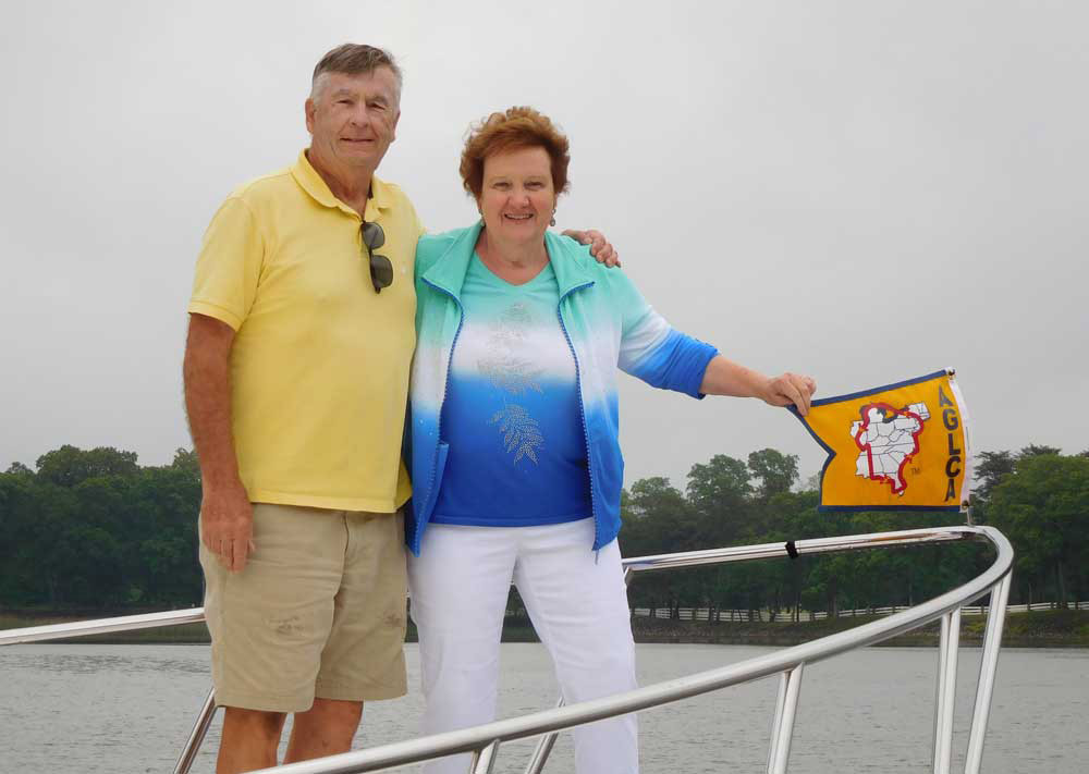
Some of the flotilla members went down south to Tarpon Springs, where they were having a major seafood festival. After spending 3 days in Clearwater resting, due to lack of marina space in Tarpon Springs they decided to head south to Ft. Myers, where they ended up spending 3½ months in a very nice downtown marina. Dick said, “We enjoyed excellent weather all winter and loved being within walking distance of a vibrant, restored city center.”
Time to cross Florida
In March, it was time to cross Florida. The Radlinskis elected to take the shortcut of the Okeechobee Waterway. With its five additional locks under their belt, they had transited 150 in total since they left their home. Some Loopers, after they reach Florida’s West Coast, choose to go to the Florida Keys and then around Key West instead of crossing on the Okeechobee Waterway. A number of them travel out from the Keys to the Bahamas.
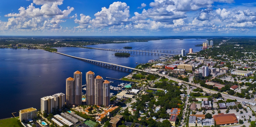
Ft. Myers lies on the shores of the Caloosahatchee River, 12 miles up from the Gulf. The river then travels east from Ft. Myers into a canal system and through three locks before entering Lake Okeechobee, a very large, muddy, and shallow lake. On the east side of the Lake, there is another canal system and two more locks, ending in the St. Lucie River which flows to Stuart on the East Coast just off the Atlantic Intracoastal Waterway (AICW).
After crossing Florida from west to east, the Radlinskis spent a month at a marina in downtown Stuart on the east coast near the AICW, enjoying more excellent Florida weather that was 80°F and sunny every day while the winter in the North chilled people. They got ready for the last leg of their America’s Great Loop adventure.
Heading home on the AICW
On April 1, 2017, they started up the AICW, a 1,150-mile trip. Although they had a few windy days where they stayed in port, overall they had very good weather. On their way north heading home, they stopped over and visited 20 locations, such as Daytona Beach and St. Augustine, Florida; Hilton Head, and Charleston, South Carolina. They didn’t spend too much time in any spot. At that point, they were anxious to get home and to complete their loop. They kept moving north. It took them 27 days to reach home in the Chesapeake Bay area. Since then, they have been flying an AGLCA burgee with a gold background, indicating that they are now “Gold Loopers.” It says, “We Completed America’s Great Loop!”
As we talked about in Part 1, Looper boats usually fly a burgee (small flag) on the bow (front of the boat) that identifies the fact that the boats are on the Loop. It is a great way to meet other Loopers and boaters who are interested in doing the Loop. Again, as we also learned from the Radlinskis’ experiences during their 6,000-mile journey, in Parts 1 and Part 2 of this article, don’t be surprised if complete strangers offer to help you. That is the pleasure boater’s way of paying a favor forward.
For any pleasure boater, completing America’s Great Loop is a monumental accomplishment, let alone a great adventure that many of us can only dream of. As one of my very experienced boating friends put it, he would have to change his wife if he really was to do it. But what about the Radlinskis, would they do the Great Loop again? After all, many couples have done it multiple times. It seems that Dick is ready to do it again, but Phyllis is more measured with her enthusiasm, saying that she doesn’t mind doing it again, but only the Canada leg of it. In my case, my wife does not mind doing the Atlantic leg, the AICW. So neither Dick nor I need to face a change in our marital lives, thank goodness.
Well, that’s it for now. Stay well. I hope to say hello to you if you spot my boat, Life’s AOK, in one of the locations that I’m hoping to visit in 2021, that is if Coronavirus permits us.
I bid you Fair Winds and Following Seas.
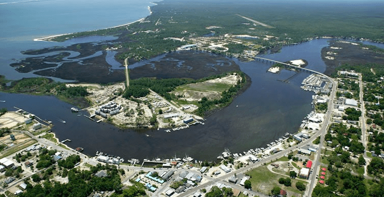
Cover photo: Ft Myers and Caloosahatchee River, Florida
3 things I learned
- The Radlinskis started planning and preparing for their America’s Great Loop adventure 6 years prior to their start date. For the planning, as well as during the trip, Dick used Navionics software and Active Captain, as well as paper charts and reference books.
- America’s Intracoastal Waterways consists of three non-contiguous segments: The Atlantic Intracoastal Waterway (AICW), extending from Portsmouth, Virginia (milepost 0.0) to Key West, Florida; a section of the Gulf Intracoastal Waterway (GICW) beginning at Tarpon Springs, Florida, and extending south to Fort Myers; and a second section of the Gulf Intracoastal Waterway extending from Brownsville, Texas to St. Marks, Florida.
- Lake Okeechobee and the Okeechobee Waterway are located in central and southern Florida. The 451,000 acre lake and 154-mile-long waterway extends from the Atlantic Ocean at Stuart, to the Gulf of Mexico at Ft. Meyers, where the Radlinskis enjoyed the city and spent 3½ months. The waterway runs through Lake Okeechobee and consists of the Caloosahatchee River to the west of the lake and the St. Lucie Canal east of the lake. Lake Okeechobee and the Okeechobee Waterway Project is part of the complex water management system known as the Central and Southern Florida Flood Control Project.
1 thing I recommend
- The road to your dreams isn’t always easy to navigate but worth the trip.
How easy?