How to cross the Albemarle Sound of North Carolina

Estimated reading time: 8 minutes – SBFL 22* – PLANNING TO VISIT – Perhaps I should reword the heading of this post as, “How would I cross the Albemarle Sound?” Why? It’s because on our way down to Florida following the Atlantic Intracoastal Waterway (ICW), I’m not planning to take the most common route of a typical boater. Why? It’s because, given the reality of the Albemarle Sound and me, the captain of Life’s AOK, Mr. Fairweather Boater, I need to be near-shore and see land at all times. There you have it.
A typical ICW traveler in Virginia going down to Florida from the North would either take the Dismal Swamp Canal down to Elizabeth City and the Pasquotank River or, as most ICW travelers do, would take the Albemarle-Chesapeake Canal (Virginia Cut) to reach the Albemarle Sound. Then, of course, once they are at the Albemarle Sound, they either head to the Alligator River or Croatan Sound.
Non-eventful or Temperamental
Crossing the Albemarle Sound on a good day should not be an eventful boating activity. As a matter of fact, Dorothea and Stuart E. Jones, coauthors of the original Slow Boat to Florida story, published in the 1958 National Geographic Magazine, have a single line of entry about their crossing. They were returning back to Elizabeth City from their overland excursion to Outer Banks (OBX). Then they wrote, “Snug again in Tradewinds (the Jones’ sailboat) we cruise southward across Albemarle Sound.” That is it. As our avid readers already know, the Jones’ story is the source of our inspiration for this series. Our plans, and our version of Slow Boat to Florida, are taking place more than half a century later to see what is new and has changed since then.
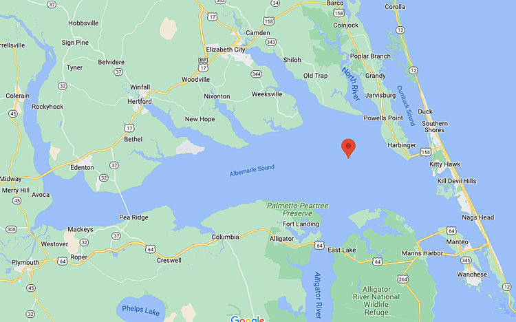
Our second source of inspiration is the 1973 book published by National Geographic titled, America’s Inland Waterway by Allan C. Fisher, Jr. He had a different take and insight on the Albemarle Sound. He wrote, “Notorious Albemarle Sound. Many experienced boatmen think it the roughest, most treacherous body of water on the entire Atlantic Intracoastal route. Here the seas often become highly unpredictable, and the waves take on a steepness not always warranted by the strength of the wind.” Apparently, when they began crossing the Sound, the breeze was about 10 knots. However, the water felt to them much rougher than it should be at the 10 knots range. By the time they reached the broad mouth of the Alligator River, the wind velocity had picked up to nearly 20 knots. Their sailboat Andromeda was pitching and rolling under power. They were concerned about slamming the keel on the bottom while in the trough of a wave.
I reached back to George Benz, one of the captains that we interviewed for our post titled, 6 tips for the Atlantic ICW journey and the story of Makau. I asked him about his experience of crossing the Albemarle Sound. He couldn’t recall any difficulty or discomfort while crossing it. However, he remembered very well his treacherous crossing of the Potomac River in the Chesapeake Bay.
The reason for the unpredictability of the Albemarle Sound has to do with having relatively shallow waters and winds that, due to the nature of its geography, produce closely packed waves that are always steep and unable to establish a pattern. Hence, at times, it can and does become extremely temperamental. Make no mistake about it.
It’s more than just another body of water to cross
Perhaps to most ICW boaters, the Sound is just another body of water on the ICW. They may not focus on it or think about it while crossing it. Here is a fun fact for you. It is the second-largest estuary in the U.S. and plays an essential role in the history of the region. It provides access to both the OBX and the Inner Banks of North Carolina. It has principal importance to the fisheries of the eastern seaboard. Because of the inlets leading to the ocean, the water is fresh in a part of its length, then it becomes brackish plus relatively shallow. That is much celebrated by commercial crabbers.
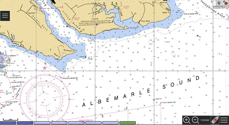
This body of water literally stretches hundreds of miles and is one of the longest estuaries in North Carolina, leading, eventually, into a number of rivers, specifically the Roanoke and Chowan Rivers, both of which extend all the way into the state of Virginia. As a result of the Albemarle Sound’s expanse, and the variety of regions that connect to it, many different habitats, ecosystems, and landscapes can be found adjacent to the Sound’s borders. Its estuaries and branches cut into virtually every region of the eastern half of North Carolina, and its miles of open water in between are easy to explore by just about anyone with a boat and a sense of adventure.
Further inland from the OBX, the narrower portions of the Sound give way to expansive wetlands, marshes, and even salty swamps that run wild with different species of birds, amphibians, reptiles, fish, and mammals.
During the initial settlements in colonial times, unlike other locations along the East Coast, North Carolina developed over land due to the shallowness of its shores. Basically, most settlers moved south from Virginia. The English came down the Chowan River in the 17th century in search of game and new land. England claimed all the land between Virginia and the Albemarle Sound and called it the County of Albemarle after George Monck, the Duke of Albemarle, one of eight noblemen who owned the Carolina colony.
Continuing down south on the ICW, most boaters aim for the Alligator River. The river flows north (this is not a typo) from its source at Little Alligator Lake. When it reaches and empties into the Albemarle Sound, it is about three miles wide. The southern shore of the Albemarle Sound remains largely undeveloped, though many acres of marsh on the peninsula have been drained in recent years so that large corporate farms can grow corn, soybeans, and winter wheat.
Albemarle Loop to consider
In our case, we are planning to take the Dismal Swamp – Elizabeth City route. While we are at Elizabeth City, we will leave Life’s AOK there and have a few days overland excursion to the OBX. However, sooner or later, we’ll end up at the mouth of the Pasquotank River, where it empties into the Albemarle Sound. Although it’s only about 11 miles wide, I have already decided that I will not cross the Sound in one run straight down to the Alligator River. After all, this is Slow Boat to Florida, we are not rushing.
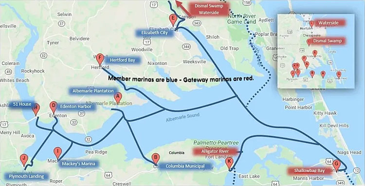
“Then what?”, you may ask. Then comes the Albemarle Loop. We would like to take advantage of this program and do a small loop while staying close to shore and going to the narrower part of the Sound and then crossing it at that point. To me, this is a win-win plan. The loop is a special program having promotional incentives. Member marinas in the loop offer 48 hours of free dockage, fresh water, and pump-out.
Edenton – prettiest small town
At the moment, we think that we will visit Edenton. It is North Carolina’s beautifully preserved first Colonial capital and a great waterfront community to visit by boat.
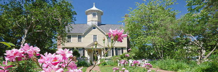
We would like to take advantage of the Albemarle Loop program. Hence, we are planning and hoping to stay at the City-owned Edenton Harbor Docks, which overlooks the 1886 Roanoke River Lighthouse and is very near to shopping, casual and fine dining, coffee shops, art galleries, historic tours, a hardware store, and a movie theater. However, at the time we posted this article, Harbor Docks “will be closed for repairs with an unknown date for reopening.” If Harbor Docks is still closed, our plan B is to stay at the Edenton Marina.
Edenton was established in 1712 as “the Towne on Queen Anne’s Creek.” It was later known as “Ye Towne on Mattercommack Creek” and still later as “the Port of Roanoke.” It was renamed “Edenton” and incorporated in 1722 in honor of Governor Charles Eden, who had died that year. Today, Edenton retains an extensive historic district with a wonderful assemblage of 18th, 19th, and early-20th-century buildings.
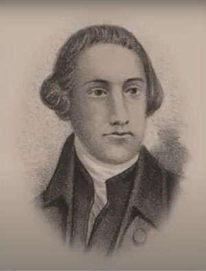
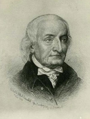
During the 18th and early 19th centuries, Edenton was a political, cultural, and commercial center in the colonies and in the fledgling nation. One of its citizens, Joseph Hewes, a congressman who resided in Edenton, was a signer of the Declaration of Independence and another, Hugh Williamson, signed the United States Constitution. James Iredell, a local judge, was appointed by George Washington to the very first United States Supreme Court.
Decisions, decisions …
Once we’re back at Elizabeth City, especially after our excursion to the OBX, I’m not sure how we’ll feel about crossing the Albemarle Sound. Option A is to cross it in one run. That’s an 11-mile distance between the mouth of the Pasquotank River and the Alligator River on the Albemarle Sound. Our boat, Life’s AOK, is a power boat. If the weather is good and there are no unknown shoals scaring us down to 10 miles an hour, we can do 25 miles an hour and reach the Alligator River within a half-hour.
On the other hand, if we want to stick to shore and cross the sound from a narrower spot, Option B is to visit Edenton and stay there a couple of days and enjoy ourselves. That is 30 miles plus the distance from the Pasquotank River. Then, after crossing the Albemarle Sound, it’s another 30 miles plus to reach the Alligator River. Option C is to hug the shore all the way around, then go in and cross the sound in the narrower end and come back to the Alligator River. That would mean 60 miles plus and more than 3 hours or so travel time.
When the day comes, we’ll make the decision and share it with you.
Well, that’s it for now. Stay well. I hope to say hello to you if you spot my boat, Life’s AOK, in one of the locations that I’m hoping to visit in 2022, that is, if whatever the latest version of Coronavirus permits us.
I bid you Fair Winds and Following Seas.
Cover photo: Edenton Harbor Docks, Edenton, North Carolina.
A few things I learned
Elizabeth City, NC
- If you have kids on board while you are in Elizabeth City, you may want to take them to Port Discover in the downtown area.
Not too far from the waterfront, you can enjoy Charles Creek Park, located just a block away from the waterfront, a small but popular spot among locals. For young visitors, the park also features a small but always enjoyed playground. Because the park is located so close to the waterfront, boating and fishing are also popular.
If you are into all kinds of vehicle racing, and if you are there in the summertime on a Friday night, you may want to do a quick excursion to Dixieland Speedway. It is a 3/8th mile modest dirt track that attracts stock cars hoping to make it to NASCAR, as well as go-karts, motorcycle racers, and everything in between. It is located in a rural section of the region close to the Virginia border, almost in the middle of nowhere. However, the speedway has been a local institution for more than 30 years.
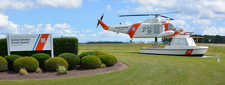
- Then you may encounter hearing the unmistakable sounds of helicopters and planes overhead of the Elizabeth City Coast Guard Air Station. It’s located along the riverfront on Route 344, just a couple miles away from the Albemarle Sound and the Atlantic Ocean. Elizabeth City is the largest and busiest US Coast Guard air station. As one of several commands located on the Coast Guard’s premier Base Elizabeth City, it also houses the Aviation Technical Training Center (ATTC) and the Aviation Logistics Center (ALC). You may hear as new recruits and seasoned pros take to the skies in extensive training, local operations, or secretive missions that occur all along the East Coast. It is a notable institution that is one of the US Coast Guard’s most acclaimed and recognized stations along the East Coast. The Elizabeth City Coast Guard Air Station ensures that the maritime traffic of the Outer Banks, the Inner Banks, and beyond remain safely protected, regardless of treacherous weather conditions or at times threats to national security.
2 things I recommend
- Consider spending a day or more in Edenton as well as Elizabeth City.
- Visit the marinas of the Albermarle Loop.
How easy?

*SBFL stands for Slow Boat to Florida. It is a series of my blog posts, which started with a posting that had the same title. Each numbered heading has two parts. The first is “Planned or Planning to visit,” and when we visit the planned location, a “Visited” label appears at the beginning, next to SBFL. The essence of this series is not to seek new lands and exotic cultures. Rather, it is to cover our journey of discovery (hence the title of our blog Trips Of Discovery) that has to do with seeing with a new eye the coastal locations of the Atlantic Intracoastal Waterway (ICW) where present-day America started to flourish. The SBFL series represents part travel, part current, and historical anthropological highlights of selected locations and coastal life. We’re comparing then and now, based on observations made by Dorothea and Stuart E. Jones in their 1958 National Geographic article titled, “Slow Boat to Florida” and a 1973 book published by National Geographic, titled America’s Inland Waterway (ICW) by Allan C. Fisher, Jr. We also take a brief look at the history of the locations that I am writing about. Finally, we bundle it up with our observations during our actual visits to the locations and our interviews with local residents. Think of it as a modest time capsule of past and present. My wife and I hope that you, too, can visit the locations that we cover, whether with your boat or by car. However, if that is not in your bucket list to do, enjoy reading our plans and actual visits as armchair travelers anyway. Also, we would love to hear from you on any current or past insights about the locations that I am visiting. Drop me a note, will you?
