Experience Speaks
Estimated Reading Time: 12 minutes – *SBFL – PLANNED – As my regular readers know, my inspiration to do the over 2,400-mile round trip on the Intracoastal Waterway (ICW) came from a 1958 National Geographic article titled, “Slow Boat to Florida.” Hence, this series of SBTF blogs. At the moment, we are in the planning stage. However, I am determined not to say at the end of our planned six-month-long trip, “We made too many wrong mistakes,” as Yogi Berra once said. So, as we are planning our ICW trip on our boat, Life’s AOK, my wife and I decided to seek out the wisdom of those who have done it before and let the experience speak.
Experience it is
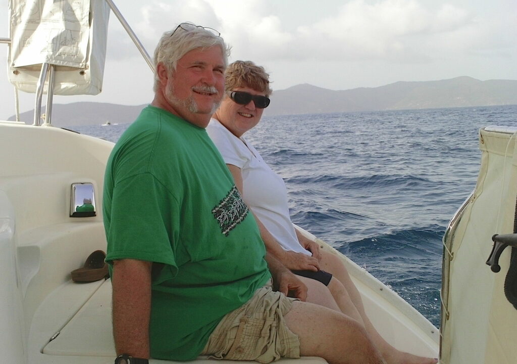
Meet Georgiana and Michael Maszczenski, a very special couple who have done the same ICW round trip, from Annapolis, Maryland, to Florida not once, not twice, but five times. Also, to our surprise, true to the spirit of this blog, they have also visited their ICW ports of call by land.
Georgiana and Michael started their relationship in high school, but boating came into their lives at different times. Mike started boating with his father when he was a teenager, on a 14’ day cruiser with an outboard on it and a bucket for ahead. They went fishing and crabbing. Georgiana’s boating experience came later. She started it after she left home and they got married. Explaining her days at home, Georgiana says, “my mother was definitely afraid of water. She got seasick easily.” Apparently, her dad went fishing in a boat, but she never knew about it until her early 20s.
Boat navigation in the early 80s was still fun, but not a cakewalk
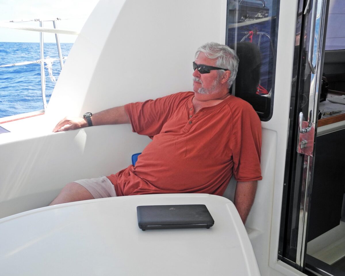
Michael’s first Atlantic ICW trip was in the early 80’s, serving as a crew member on a friend’s boat, a 38’ Cherokee Camry, a catamaran. (A catamaran is a multi-hulled watercraft, featuring two parallel hulls of equal size.) As he puts it, “It was less easy than it is today, because you did not have the ability with GPS to obtain a fixed point anytime you wanted one. That’s the big thing about navigation that I tell people today. I say, with a GPS you look down and have a fix, you know exactly where you are. So not only do you know the position you’re at, but you also can see that position on the chart, even if you don’t have a paper chart.”
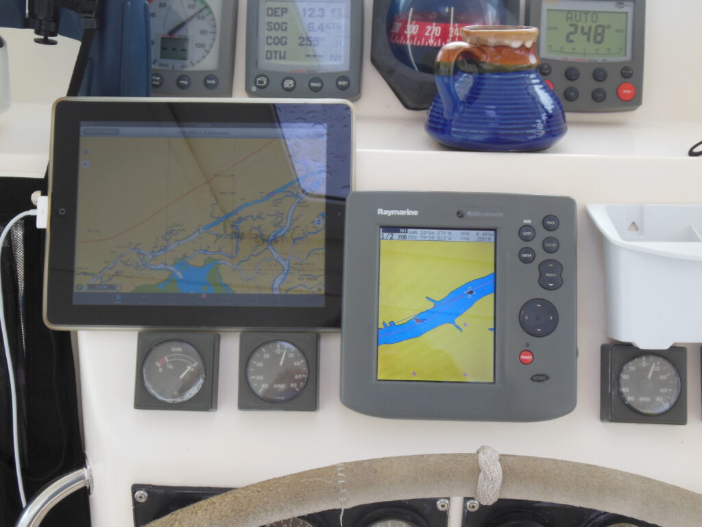
Without the benefit of a modern-day GPS Chart Plotter, in those days the “dead reckoning” technique was one of the primary approaches used for navigation. Explaining further, Michael says, “There was a lot of questions because when you had your paper charts, you had to find someplace to put a fix on (to know where you are). That means you had to identify any landmark or you had to find a feature that was placed there by the Army Corps of Engineers. If you find a mark and you could locate that mark on the chart, you had a fix because you knew where you’re at. I mean steering the boat is never a precise thing. So if you’re out in the open ocean, you say, I’m heading to 285 degrees and I’ve been sailing at 285 degrees for the last two hours at seven knots. I’m 14 miles from this last fix and this is where I am. But you know, people can’t hold the boat that close and you got tides and currents and winds. So usually where you think you are and where you are two different places.”
Michael and his friend went to Florida and back without the benefit of having today’s modern-day GPS chart plotters. It was certainly the same for the individuals that are the source of my ICW trip inspiration. They are Dorothea and Stuart E. Jones, who wrote, “Slow Boat to Florida,” and Allan C. Fisher, Jr. and his 1973 book titled, “America’s Inland Waterway, Exploring the Atlantic Seaboard.” All worked for National Geographic.
By the way, if the topic of how to navigate on the water without GPS interests you, your local boating club, which you can locate on the American’s Boating Club site, maybe offering you a “Piloting Class” to teach you how to navigate using paper charts and much more for a very reasonable fee. You can also find additional online resources of the club here. If your local squadron offers it, you may even enjoy a 10-minute free virtual boat handling class. Remember, you do not need to have a boat to join your local squadron and enjoy its privileges. Someone always needs crew; you can volunteer to crew and be able to enjoy pleasure boating. More on these topics are in my previous blog, “To have power or sailboat.”
Be it for a day trip or much longer, provisioning is the king; in this case, it is the queen
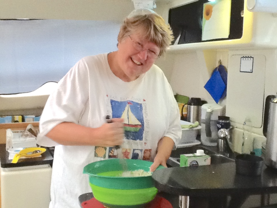
This is just in case, in addition to keeping an eye on your navigational route details, you want to eat and drink while you are on your way. I would like to share a major point of wisdom: don’t leave home without logistical consideration of your trip, well in advance. Here comes Georgiana and her pivotal role on their ICW trips. She says, “I’m in charge of provisioning; I am the provisioning officer. I do all the menu planning. I make sure that all the provisions are on board. I also do other things that are not just food.” As a member of the 5-person owner/crew of their catamaran LUX, Georgiana also does communications and writes about the fun side of S/V LUX in a travel blog for their boat. She says, “We literally started the blog so that family would know where we were. So that they would know we were safe and everything was okay.”
Georgiana, as the officer in charge of “finding stuff” at a port of call, finds whatever the boat and the crew needs. “Like when I come into port, one of our team members always looks at me and says, ‘So where are we going? What are we doing? What kind of shopping are we having?’” Besides grocery shopping, one of the big things is finding laundromats along the way, if the marina doesn’t provide laundry facilities. She is also the medical officer of the boat and in charge of keeping all the medical necessities up to date and directing other people on how to take care of any wounds.
On the surface, it might be seemingly easy, but when scaled up, it’s a difficult task of provision planning and providing. Georgiana says, “I realized people may not be that flexible on provisions. It sounds like an easy job until you realize that you have to plan for a 42-day, long-distance first cruise. So you start at the beginning and work your way backwards. Michael eats anything. I can’t have citrus. Another member of the 7-person crew can’t tolerate oil very well. One is a diabetic and another is vegetarian, so I’m planning for those constraints.”
How do they plan the daily cruise schedule? Generally, they try to plan no longer than eight hours sailing in a day and use cruising guides. “You always had to remember and be aware of the fact that, as the day would go on, being on the boat all day, on the water, in the sun, is very difficult. So as much as possible, we tried to keep to a schedule where we’re spending no more than eight hours,” says Georgiana. She adds, “We’ve pushed 10 hours if we have to, but we like about eight hours. And so literally, what you do is figure out that night how far you’ll be able to go in eight hours and about where we’ll be able to break at the end of the next day. Then you start looking at the potential places to stay.” Among the many guides you may find useful, check the Cruising and Anchorage Guide to the Atlantic ICW: Revised Edition 2019, Over 300 anchorages a handy reference guide.
Read the following paragraphs very slowly, it is about the Aids to Navigation (ATONs)
If you have no interest in navigation, you can skip this section. Now, I want you to read the following paragraphs very slowly and take it all in. Are you ready? Here we go: There are two important facts to remember about aids to navigation along the Intracoastal Waterway: they run clockwise around the coast and they are uniquely marked.
Because the ICW runs along the shore, the conventional adage of “red, right, returning from seaward” becomes unclear. So the Coast Guard adopted the following clockwise convention: moving in a southerly direction along the Atlantic Coast, then in a northerly, then westerly direction along the Gulf Coast, is considered returning from seaward. You can remember this rule as “red, right, returning to Texas.”
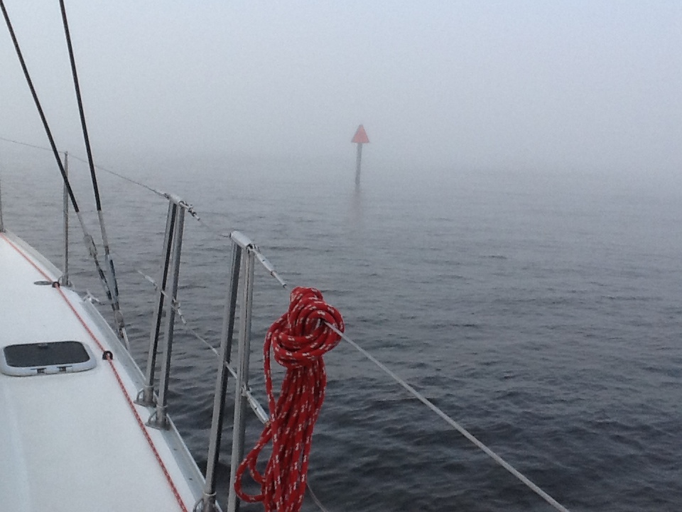
Occasionally, given the ICW’s frequent crossing and joining of established waterways, you often experience a sudden change in marks. For example, colored aids to navigation “swap sides” three times near the Savannah River intersection.
You got that? Will you remember the information when you need to while cruising on the ICW? Okay, at least when you need it, you can read relevant resources and learn something like the Atlantic Intracoastal Waterway reference guide, right? Maybe. If you are cruising, you will not have time to do anything but pay attention to your surroundings and signage.
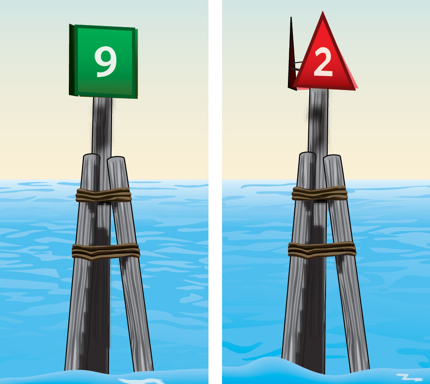
Well, here, experience speaks, again. One of the great tips that this couple offers is to have little red and green cutouts that have velcro backs to be used as visual reminders to be placed on your dashboard or hull. You can flip them as necessary to remember which side the green square (going away from the land) is supposed to be and which side is the opposite, the red triangle (going back to land).On the ICW, the marks are based upon the flow. If you go into a river, now you’re going with the flow of the river, whether you’re going into a town or out of a town. So it’s possible that the mark that you’re looking at can be on either side of the boat, depending on precisely where you are located.
Only experience can tell you this
Michael says closely following the coastal weather forecast is a must. Back in the 80s, they did not have any reliable weather forecasts and at best, it was good for a day. These days, forecasts are reliable 3-4 days out.
Another tip that the couple offers is to be on the lookout for the depth of the waterway. On the ICW, silt and sand shifts with the currents, making navigation trickier. ICW lines that mark the center area on paper charts may not be reliable at times. Make sure to use the most recently updated charts on your GPS Chart Plotters.
Lastly, Michael will tell you to stay off the ICW at nighttime. Remember, safety comes first. At night, commercial vessel traffic can pose serious navigation challenges to pleasure boaters.
Georgiana’s most important tip is to select marinas that are close to grocery stores, offer you a loaner car, or take you to a big grocery store.
The couple’s favorite spot on the Atlantic ICW? Without hesitation, the couple declares it is St. Augustine,
Florida. It’s a beautiful, historic town with lots of things to see and do. Its municipal marina
is near everything including the downtown, which is within walking distance. It has access to groceries, laundromats, and a West Marine.
This year, the couple, along with their three cruise mates, are planning their sixth ICW trip, starting in October 2019, after the Annapolis boat show. They will first go down to Georgia and leave their catamaran LUX there for the winter. Then they’ll go back, pick it up in the spring, and continue to Florida and the Bahamas.
7 things I learned
- Be it for short or long-distance pleasure boat trips, it definitely pays off to have some boating safety and navigation education, even if you have a GPS or two on your boat.
- One hour on the water equals four hours on the land. Plan your drinking water accordingly.
- You must plan for your provisions and medications on all your boat trips.
- You must plan your trip and share it with a trusted person on land. While you are executing your plan, check-in daily with that person, so that if they do not hear from you for more than 24 hours, they would contact the authorities or the U.S. Coast Guard.
- There is a large set of planning and reference resources for the ICW trip. It is a must to take advantage of them.
- Have little red triangle and green squares that have velcro backs. So you can flip them as needed to remember which side is the green square (going away from the land) and which side is the opposite, red (going back to land).
- Pay attention to extended marine weather forecasts picked up by your boat radio.
10 things I recommend
- Any type of travel, including “armchair travel,” is more fun with a friend or two. Even a virtual trip, like reading my blog, can be a powerful shared experience. Having a travel group can also expose you to new destinations that you may not have considered or found on your own.
- Attend your local boating club’s training classes. They offer ample opportunity for that. You can locate your local club and find additional online resources on the America’s Boating Club site here.
- Study ICW resources as much as possible. A good example is the ICW Mile by Mile Guide.
- You must plan for your provisions and medications for all your trips.
- While you are on the boat, start drinking water, well before you feel thirsty and drink plenty of water. Remember, if you do not drink any water for one hour on the water, that equals to not drinking any water on land for four hours.
- If you feel that something is going wrong on the boat and an ugly emergency may, just may, show its head on the boat, don’t wait until you have to do an emergency call using “May-Day.” Instead, start communicating your issue using the “Pan-Pan” message on Channel 16 of your boat radio.
- Keep a heavy, steady binocular handy at all times.
- No matter what kind of engine you have on your vessel, and what your plans are, plan your refueling distances carefully and refuel as soon as you arrive at your selected marina. The rule is ⅓ tank going, ⅓ tank returning, ⅓ tank reserve.
- Either on your boat radio or on the Internet, monitor the Marine Weather Forecast provided by NOAA’s National Weather Service at all times. Also, download the MyRadar Pro application onto your cell phone and/or tablet computer. It will give you fantastic insights about atmospheric events in your vicinity and beyond.
- Keep your GPS Charts updated. One of the best chart software that you can buy for your GPS Chart Plotter is Navionics. It is regularly updated by the company and its users.
How easy?
Marinas where you can tie your boat on the ICW
- Try ICW Mile by Mile Guide
- Check out MarinaLife Magazine and its MarinaLife ICW Cruise Itineraries
Places to stay, besides your boat
I am in search of the highest number of round trips that were done by a person or a group. Do you know any pleasure boaters who have done the ICW more than 10 times?
*SBFL stands for Slow Boat to Florida. It is a series of my blog posts, which started with a posting that had the same title. Each numbered heading has two parts. The first is “Planned,” and when we visit the planned location, a “Visited” label appears at the beginning, next to SBFL. The essence of this series is not to seek new lands and exotic cultures. Rather, it is to cover our journey of discovery (hence the title of our blog Trips Of Discovery) that has to do with seeing with a new eye the coastal locations of the Atlantic Intracoastal Waterway (ICW) where present-day America started to flourish. The SBFL series represents part travel, part current and historical anthropological highlights of selected locations and coastal life. We’re comparing then and now, based on observations made by Dorothea and Stuart E. Jones in their 1958 National Geographic article titled, “Slow Boat to Florida” and a 1973 book published by National Geographic, titled America’s Inland Waterway (ICW) by Allan C. Fisher, Jr. We also take a brief look at the history of the locations that I am writing about. Finally, we bundle it up with our observations during our actual visits to the locations and our interviews with local residents. Think of it as a modest time capsule of past and present. My wife and I hope that you, too, can visit the locations that we cover, whether with your boat or by car. However, if that is not in your bucket list to do, enjoy reading our plans and actual visits as armchair travelers anyway. Also, we would love to hear from you on any current or past insights about the locations that I am visiting. Drop me a note, will you?


I am genuinely grateful to the holder of this web page who has shared this wonderful paragraph at at this time.
Hi there, this weekend is nice in support of me, because this moment i am reading
this wonderful informative article here at my home.
When someone writes an article he/she maintains
the idea of a user in his/her brain that how a user can know it.
Therefore that’s why this post is great. Thanks!
Hello, I enjoy reading through your article. I wanted to write a little comment to support you.
Thank you for your interest. If you have a travel-related article, you are welcome to submit any coastal living/lifestyle/travel article. In order to reflect the spirit of TripsofDiscovery.com, your location needs to be accessible by boat and car, anywhere in the world, allowing readers to use either vehicle to visit the site you are writing about. Photos of the location are welcome. When you contribute content to our site, it needs to have a Creative Commons license. We can help you with that.
Please let me know if you’re looking for a article author for your blog.
You have some really good posts and I feel I would be a good asset.
If you ever want to take some of the load off, I’d absolutely love to write some content for your blog in exchange for a
link back to mine. Please send me an email if interested.
Cheers!
Howdy! I could have sworn I’ve visited this blog before but after browsing through some of the
posts I realized it’s new to me. Regardless, I’m definitely happy I came across it and I’ll be bookmarking it and
checking back frequently!